Current bridge is the main one; smaller one built earlier was to support its construction
India is closely monitoring the construction of a bridge by China on the Pangong Tso (lake) in eastern Ladakh, which is in “occupied territory”, the Ministry of External Affairs (MEA) said on Thursday. Sources in the security establishment stated that a broad bridge was currently under construction, connecting both sides of the lake, which would significantly cut down time for the People’s Liberation Army (PLA) to move troops and armoured vehicles, while a smaller bridge built early this year was intended to support construction of the main one.
Official sources said the construction of the main bridge had just commenced and the small bridge, of which satellite images had come out in January, was not a “permanent bridge” but a bailey bridge to support the construction of the main one.
“The smaller bridge for which construction started in October 2021 and went on till January this year, recommenced in March and was completed by April. It is a support bridge to support the construction of a bigger and broader one. The height of the earlier one is so low that patrol boats can’t pass under it,” a source in the security establishment said on condition of anonymity. “This is a pattern they follow in other places as well. So, it cannot be called a second bridge.”
Responding to questions on this at the weekly press interaction, MEA Spokesperson Arindam Bagchi said, “We have seen media reports on a new bridge or expansion of old ones. This is a military issue so I can’t discuss implications. But India has always believed this area is occupied territory. We continue to monitor such developments.”
On the ongoing stand-off in eastern Ladakh, Mr. Bagchi observed that talks on the situation at the LAC were on and External Affairs Minister S. Jaishankar conveyed India’s concerns to his Chinese counterpart FM Wang Yi during his visit.
Construction just commenced
On the current status of construction, the source cited above said that construction material were dumped last month and the work on the main bridge had just commenced. “Latest satellite images show piers, construction material and cranes on the site now.”
Stating that it doesn’t make sense to have two bridges at the same location, the source noted that the main bridge was much higher and broader that would allow the PLA to move troops as well as armoured vehicles.
As reported earlier, the bridge connecting the north and south banks of Pangong Tso would significantly bring down the time for the PLA to move troops and equipment between the two sectors. In addition, the induction of troops from the G219 highway would come down by 130 km due to this bridge, another source noted.
On the north bank there is a PLA garrison at Kurnak fort and another on the south bank at Moldo. The distance between the two is around 200 km and the bridge was between the closest points on the two banks, which is around 500m. This officials had said will bring down the movement time between the two sectors from around 12 hours to three-four hours. Officials had stated earlier that the bridge is located around 25 km ahead of the Line of Actual Control (LAC). It will reduce the overall distance by around 140-150 km.
Earlier, the PLA had to take a roundabout crossing the Rudok county but now the bridge would provide a direct axis, the biggest advantage being that time for inter-sector movement comes down significantly.
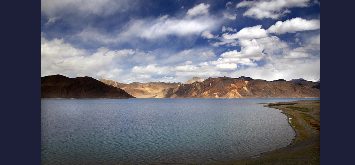
Boomerang shaped lake
India holds one-third of the 135-km-long boomerang shaped lake located at an altitude of over 14,000 feet. The lake, a glacial melt, has mountain spurs of the Chang Chenmo range jetting down, referred to as fingers.
The north bank, which has much higher differences in perception of the LAC than the south one, has been the initial site of the clashes in early May 2020 while tensions on the south bank had flared up later in August. The Indian Army gained tactical advantage over the PLA on the south bank in end-August by occupying several peaks lying vacant since 1962 gaining a dominating view of the Moldo area. On the north bank too, Indian troops set up posts facing PLA positions on the ridgelines of Finger 4.
In February 2020, as a part of the first phase of disengagement, both sides agreed for a complete disengagement on the north and south banks. The Indian Army has a permanent position near Finger 3, the Dhan Singh Thapa post, while the PLA has a base east of Finger 8. The south bank leads to the Kailash range and to the Chushul sector. As reported by The Hindu earlier, China had intensified construction work behind the main confrontation points in Aksai Chin.
Pangong bridge construction is in ‘occupied territory’: Centre
Current bridge is the main one; smaller one built earlier was to support its construction
India is closely monitoring the construction of a bridge by China on the Pangong Tso (lake) in eastern Ladakh, which is in “occupied territory”, the Ministry of External Affairs (MEA) said on Thursday. Sources in the security establishment stated that a broad bridge was currently under construction, connecting both sides of the lake, which would significantly cut down time for the People’s Liberation Army (PLA) to move troops and armoured vehicles, while a smaller bridge built early this year was intended to support construction of the main one.
Official sources said the construction of the main bridge had just commenced and the small bridge, of which satellite images had come out in January, was not a “permanent bridge” but a bailey bridge to support the construction of the main one.
“The smaller bridge for which construction started in October 2021 and went on till January this year, recommenced in March and was completed by April. It is a support bridge to support the construction of a bigger and broader one. The height of the earlier one is so low that patrol boats can’t pass under it,” a source in the security establishment said on condition of anonymity. “This is a pattern they follow in other places as well. So, it cannot be called a second bridge.”
Responding to questions on this at the weekly press interaction, MEA Spokesperson Arindam Bagchi said, “We have seen media reports on a new bridge or expansion of old ones. This is a military issue so I can’t discuss implications. But India has always believed this area is occupied territory. We continue to monitor such developments.”
On the ongoing stand-off in eastern Ladakh, Mr. Bagchi observed that talks on the situation at the LAC were on and External Affairs Minister S. Jaishankar conveyed India’s concerns to his Chinese counterpart FM Wang Yi during his visit.
Construction just commenced
On the current status of construction, the source cited above said that construction material were dumped last month and the work on the main bridge had just commenced. “Latest satellite images show piers, construction material and cranes on the site now.”
Stating that it doesn’t make sense to have two bridges at the same location, the source noted that the main bridge was much higher and broader that would allow the PLA to move troops as well as armoured vehicles.
As reported earlier, the bridge connecting the north and south banks of Pangong Tso would significantly bring down the time for the PLA to move troops and equipment between the two sectors. In addition, the induction of troops from the G219 highway would come down by 130 km due to this bridge, another source noted.
On the north bank there is a PLA garrison at Kurnak fort and another on the south bank at Moldo. The distance between the two is around 200 km and the bridge was between the closest points on the two banks, which is around 500m. This officials had said will bring down the movement time between the two sectors from around 12 hours to three-four hours. Officials had stated earlier that the bridge is located around 25 km ahead of the Line of Actual Control (LAC). It will reduce the overall distance by around 140-150 km.
Earlier, the PLA had to take a roundabout crossing the Rudok county but now the bridge would provide a direct axis, the biggest advantage being that time for inter-sector movement comes down significantly.
Boomerang shaped lake
India holds one-third of the 135-km-long boomerang shaped lake located at an altitude of over 14,000 feet. The lake, a glacial melt, has mountain spurs of the Chang Chenmo range jetting down, referred to as fingers.
The north bank, which has much higher differences in perception of the LAC than the south one, has been the initial site of the clashes in early May 2020 while tensions on the south bank had flared up later in August. The Indian Army gained tactical advantage over the PLA on the south bank in end-August by occupying several peaks lying vacant since 1962 gaining a dominating view of the Moldo area. On the north bank too, Indian troops set up posts facing PLA positions on the ridgelines of Finger 4.
In February 2020, as a part of the first phase of disengagement, both sides agreed for a complete disengagement on the north and south banks. The Indian Army has a permanent position near Finger 3, the Dhan Singh Thapa post, while the PLA has a base east of Finger 8. The south bank leads to the Kailash range and to the Chushul sector. As reported by The Hindu earlier, China had intensified construction work behind the main confrontation points in Aksai Chin.


NO COMMENT